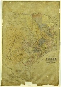
Tejano History
1846 Republic of Texas
Map/Doc #: 1891
Digital TIF Size: 453.09 MB
Digital PDF Size: 140.17 MB
Subject: Republic Maps.
Title 1: Map of Texas, Compiled from surveys on record in the General Land Office of the Republic to the year 1839
Region: Texas
Creation Date: xx/xx/1891
Publisher: Richard S. Hunt and Jesse F. Randel
Compiler: Richard S. Hunt, Jesse F. Randel
Draftsman: Sid. J. Rowe (copied by)
Size: (in inches) 36.6 x 25.7
Format: 1 map; tracing, colored
Scale Per Inch: 20 miles
Collection: State
Comments: Facsimile tracing, copied in 1891.
Maps courtesy of Texas General Land Office


