Tejano History
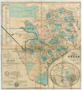
1851 Map of the State of Texas Roads
Map/Doc #: 442
Digital TIF Size: 536.56 MB
Digital PDF Size: 11.62 MB
Subject: State Maps.
Title 1: J. De Cordova's Map of the State of Texas Compiled from the records of the General Land Office of the State by Robert Creuzbaur
Region: Texas
Creation Date: xx/xx/1851
Publisher: Jacob De Cordova
Printer: J. M. Atwood, Engraver, New York
Place Published:
Houston, [Texas]
Compiler: Robert Creuzbaur
Draftsman: Robert Creuzbaur
GLO Commissioner: Thomas William Ward, George W. Smyth
Size: (in inches) 32 x 34.9
Format: engraving
Scale Per Inch: 20 miles
General Features: roads, cities, counties, geographical features, notes about flora and fauna
Collection: State
Comments: Inset shows Texas in present configuration after Compromise of 1850.
Conserved in 2001 with donations from Clear Lake Area Chamber of Commerce and Clear Lake and NASA Area Convention and Visitors Bureau.
Maps courtesy of Texas General Land Office


